


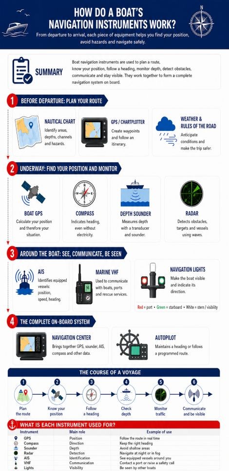
How do a boat’s navigation instruments work?
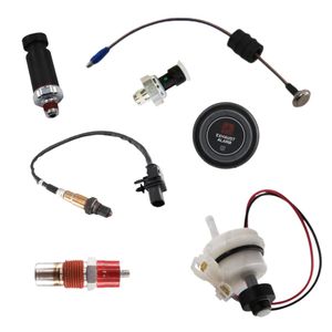
GPS units, depth sounders, VHF radios, navigation lights, accessories and equipment to navigate with greater peace of mind.
A boat navigation system is a set of complementary instruments. The nautical chart prepares the route, the GPS locates the boat, the compass indicates the heading and the depth sounder measures the depth. The radar detects obstacles, AIS identifies equipped vessels, the VHF radio enables communication and navigation lights make the boat visible. Each device provides different information to help the skipper find their position, anticipate hazards and navigate more safely.
- What are the main boat navigation instruments?
- How does a nautical chart work in boat navigation?
- How does a boat GPS or chartplotter work?
- How does a boat compass work?
- How does a boat depth sounder work?
- How does a boat radar work?
- How does AIS work in boat navigation?
- How does a marine VHF radio work?
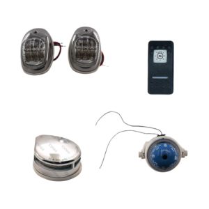
- What are boat navigation lights used for?
- How does a boat navigation system display work?
- How does a boat autopilot work?
- How do navigation instruments work together?
- Which navigation instruments should you choose for your boating programme?
- Which boat navigation instrument should you remember for each use?
- What common questions should you ask about boat navigation instruments?
What are the main boat navigation instruments?
Boat navigation instruments are the devices that help you prepare a route, follow a position, maintain a heading, monitor depth, detect obstacles, communicate and remain visible. To understand their role quickly, the simplest approach is to classify them according to the information they provide to the skipper.
To place these devices within how a boat works, they should be seen as a decision-support layer: they do not replace seamanship, but complement propulsion, electricity, safety and manoeuvring.
| Instrument | Role in the navigation system | Information provided |
|---|---|---|
| Nautical chart | Preparing the route and identifying hazards | Depths, buoyage, channels, risk areas |
| GPS / chartplotter | Locating the boat and following an itinerary | Position, speed over ground, route, waypoints |
| Compass | Indicating the direction to follow | Heading in relation to magnetic north |
| Depth sounder | Monitoring the depth under the boat | Water depth, seabed relief depending on the model |
| Radar | Detecting obstacles around the boat | Echoes from vessels, coastlines, buoys or obstacles |
| AIS | Identifying equipped vessels nearby | Name, position, speed and heading of vessels |
| Marine VHF | Communicating with ports, boats and rescue services | Radio messages, safety calls, weather information |
| Navigation lights | Being visible and indicating the boat’s orientation | Port, starboard, stern, anchor light depending on the light |
| Navigation system display | Bringing together data from several instruments | Position, depth, wind, speed, AIS, engine data |
| Autopilot | Maintaining a heading or following a programmed route | Heading followed, course corrections |
These instruments can work on their own, but their real effectiveness appears when they are used together. A GPS indicates the position, but that position becomes much more useful when displayed on a nautical chart. A depth sounder measures depth, but that information becomes more meaningful when compared with the chart. AIS shows equipped vessels, while radar completes the surveillance around the boat.
To build a coherent setup, DAM Marine offers a selection of boat navigation equipment suited to common onboard needs.
How does a nautical chart work in boat navigation?
The nautical chart is the tool that helps you understand the area in which the boat is going to navigate. It shows depths, shoals, rocks, channels, buoys, beacons, regulated areas, ports, anchorages and the main useful landmarks. It is used to prepare a route before departure, but also to monitor navigation once at sea.
A nautical chart can be used in paper form or electronically in a GPS chartplotter. In both cases, it gives the skipper a structured reading of the environment. Without a chart, a GPS position is only a coordinate. With a chart, that position becomes understandable: the boat is in a channel, near a hazard, on a clear route or close to an area to avoid.
What is the role of the nautical chart in the navigation system?
The nautical chart is used to prepare the passage. The skipper can identify the departure point, arrival point, mandatory passages, shallow areas, hazards to avoid and possible shelters in case the weather changes.
Why keep a paper chart on board?
A paper chart remains useful because it does not depend on electricity, a screen, software or a battery. If the electronics stop working, it helps maintain an overall view of the navigation area.
On a well-prepared boat, paper charts and electronic charts are not opposites. The electronic chart provides comfort and display accuracy, while the paper chart offers extra safety in the event of a technical problem.
How does a boat GPS or chartplotter work?
The boat GPS lets you know the boat’s position in real time. It receives signals sent by several satellites, then calculates the boat’s position in latitude and longitude. This position can be displayed as coordinates or placed directly on an electronic nautical chart.
The GPS chartplotter goes further than a simple GPS. It displays the boat’s position on a chart, allows you to create waypoints, follow a route, check speed over ground and see the difference between the planned route and the route actually followed.
What is the role of GPS in a boat navigation system?
GPS indicates where the boat is. This information is essential for checking progress, correcting a trajectory and avoiding drift towards a hazardous area under the effect of wind or current.
What is the difference between position, route and heading?
Position is where the boat is located. Route is the planned or actual track on the chart. Heading is the direction in which the boat is pointing.
A boat can keep a steady compass heading while following a slightly different route because of current or wind. The GPS shows the real movement over the seabed, while the compass indicates the boat’s immediate direction.
To complete your installation, you can browse the GPS units and boat navigation equipment available from DAM Marine.
How does a boat compass work?
The boat compass indicates the heading, meaning the direction followed in relation to magnetic north. It is one of the most important instruments on board because it can work without satellites, without electronic charts and without an electrical power supply.
A magnetic compass uses a magnetised card that naturally aligns with the Earth’s magnetic field. The skipper then reads the graduation corresponding to the boat’s direction. Its operation is simple, but installation must be careful to avoid disturbances caused by nearby metal or electrical elements.
What is the role of the compass in the navigation system?
The compass is used to follow a direction. The GPS is then used to check whether the actual route followed matches what was planned on the nautical chart.
What is a hand-bearing compass used for?
A hand-bearing compass is used to sight a visible point, such as a lighthouse, buoy, beacon or coastal landmark. By plotting several bearings on a chart, the skipper can confirm the boat’s position.
The compass is therefore complementary to GPS. The GPS gives the position and actual route, while the compass gives an immediate direction. In the event of an electronic failure, it becomes a particularly important backup instrument.
How does a boat depth sounder work?
The boat depth sounder measures the depth below the hull. It indicates the available water height between the boat and the seabed. This information is essential for avoiding shoals, approaching a port, choosing an anchorage or navigating in shallow waters.
To go further when dropping anchor, our guide to boat anchoring techniques directly complements the use of the depth sounder, especially for choosing depth and adapting chain length.
The depth sounder works with a probe, also called a transducer. This transducer sends a sound signal towards the seabed. When the signal meets the bottom, it returns to the transducer. The device measures the signal’s return time and calculates the depth.
What is the role of the depth sounder in the navigation system?
The depth sounder checks the real depth below the boat. The nautical chart shows theoretical depths, while the depth sounder provides an instant measurement.
Why is the depth sounder also useful at anchor?
At anchor, the depth sounder helps you choose an area with suitable depth. It helps avoid water that is too shallow, an area that is too deep or a spot unsuitable for the available chain length.
The depth sounder also helps protect submerged elements of the boat, such as the outdrive, shaft line or propeller. A grounding impact can damage a propeller or cause vibrations. To learn more, you can read our article on how a boat depth sounder works or our guide to how a boat propeller works.
How does a boat radar work?
The boat radar detects obstacles around the boat using electromagnetic waves. The radar antenna sends waves into the environment. When they meet an object, such as a vessel, coastline, buoy or obstacle, they return to the radar as an echo.
The device analyses these returns and displays them on a screen. The skipper can then identify elements that are not always visible to the naked eye, especially at night, in fog, in rain or in a busy area.
What is the role of radar in the navigation system?
Radar monitors the environment around the boat. While GPS indicates a position on a chart, radar shows echoes corresponding to objects that are actually present around the vessel.
When does radar become really useful?
Radar becomes useful when navigating at night, in fog, in heavy rain, near a port or in an area with dense maritime traffic.
This information complements cartography, AIS and visual watchkeeping. However, interpreting radar requires some practice, as not all echoes are always easy to read depending on the conditions.
How does AIS work in boat navigation?
AIS, or Automatic Identification System, identifies equipped vessels around the boat. It works through radio data exchange. An equipped vessel can transmit information such as its name, position, speed, heading and sometimes its destination.
This information can be displayed on a navigation screen, GPS chartplotter or compatible display. The skipper can then see some of the vessels around them and better anticipate crossings.
What is the role of AIS in the navigation system?
AIS helps you better understand maritime traffic. It is particularly useful near ports, in channels, in busy areas or when a pleasure boat crosses larger vessels.
Why does AIS not replace radar or visual watchkeeping?
AIS only shows vessels that are equipped and correctly configured. Some small boats, sailing boats, tenders or light craft may not appear on the screen.
AIS must therefore be used as a complementary tool. To better understand its role, limits and uses, you can read our complete guide to how AIS technology works.
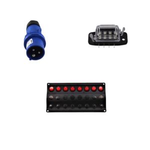
How does a marine VHF radio work?
The marine VHF radio is a radio communication device used at sea. It allows communication with other boats, ports, harbour offices and rescue services. It can also be used to receive safety messages or weather information depending on the channels used.
Unlike a mobile phone, VHF is designed for the marine environment. It operates on dedicated frequencies and allows open communication: a message can be heard by several nearby boats or stations.
What is the role of VHF in the navigation system?
VHF is not used for positioning, but it plays a central role in safety. It can be used to request information, warn another vessel or contact rescue services.
What is the difference between fixed and handheld VHF?
A fixed VHF is installed on board and connected to an antenna, which generally gives it better range. A handheld VHF is more compact and can be used on a small boat or as a backup solution.
A boat can know its position with GPS, identify a vessel with AIS or radar, then communicate with it by VHF if necessary. To go further, you can read our guide to how a marine VHF radio works.
What are boat navigation lights used for?
Boat navigation lights make the boat visible and identifiable to other vessels. They are essential at night, at dusk, at dawn or when visibility is reduced. Their role is not only to light the boat: they also indicate its orientation and sometimes its situation.
Navigation lights are therefore an integral part of the navigation and safety system. They allow other skippers to understand whether a boat is approaching head-on, moving away, showing its port side, starboard side or lying at anchor.
What is the role of navigation lights in the navigation system?
Navigation lights allow other boats to see your vessel and understand its direction. At sea, especially at night, you must be visible, identifiable and compliant with maritime traffic rules.
How do you read another boat’s navigation lights?
A red light indicates the port side, a green light indicates the starboard side and a white light may indicate the stern, anchoring or general visibility depending on the boat’s configuration.
This reading helps anticipate trajectories and apply the rules of the road. To learn more, you can read our guide to mandatory navigation lights on board, as well as our article on navigation rules at sea.
You can also find boat navigation lights and equipment in the DAM Marine navigation category.
How does a boat navigation system display work?
A boat navigation system display brings together information from several instruments. It can show GPS position, depth, speed, heading, wind, AIS data, certain engine information or even autopilot data.
Its role is to centralise information to make onboard reading easier. Instead of checking several separate devices, the skipper can find essential data on one or more displays.
What is the role of a multifunction display?
A multifunction display can show cartography, GPS position, depth sounder, radar, AIS, engine data or navigation information. It often becomes the visual heart of a modern navigation system.
What is the NMEA 2000 network used for?
The NMEA 2000 network allows the boat’s electronic equipment to communicate with each other. A GPS, AIS, depth transducer, compatible engine or autopilot can share data.
This centralisation reduces the time needed to understand the situation. To better understand engine-related systems, you can read our articles on how a boat engine fuel system works, how a marine diesel engine works or how a petrol boat engine works.
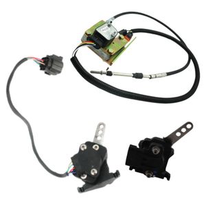
How does a boat autopilot work?
The boat autopilot maintains a heading or follows a programmed route. It uses information from the electronic compass, GPS or other sensors, then acts on the steering system to correct the trajectory.
Its purpose is to relieve the helmsman, especially during long passages or when the boat must keep a regular trajectory for several minutes or several hours.
What is the role of the autopilot in the navigation system?
The autopilot applies an instruction. It can maintain a heading chosen by the skipper or follow a route from the GPS. If the boat moves away from the planned trajectory, it sends a correction to the steering system.
Why does the autopilot depend on the steering system?
To correct the trajectory, the autopilot must mechanically act on the steering. If the steering has play, a leak or stiffness, maintaining an accurate heading can become more difficult.
The autopilot does not replace the skipper. It does not monitor obstacles on its own and does not remove the need for watchkeeping. On some boats, its action goes through a ram or a system connected to hydraulic steering. To better understand this link, you can read our guide to how a boat hydraulic steering system works.
How do navigation instruments work together on a boat?
Navigation instruments work like an information chain. The nautical chart provides context, GPS gives the position, the compass gives the direction, the depth sounder checks depth, radar detects obstacles, AIS identifies equipped vessels, VHF enables communication and navigation lights make the boat visible.
The skipper uses this information to make decisions: prepare a route, correct a heading, slow down in shallow water, contact a port, avoid a crossing situation or adapt navigation to the conditions.
How do instruments intervene during navigation?
Before departure, the chart and GPS chartplotter help prepare the route. At sea, GPS follows the position, the compass helps maintain heading, the depth sounder confirms depth and lights ensure visibility.
Why should you plan for a reliable power supply?
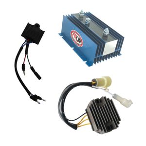
Most modern instruments depend on electricity: GPS, chartplotter, depth sounder, radar, AIS, fixed VHF, navigation system display, autopilot and navigation lights.
The reliability of the electrical installation therefore becomes central: understanding how electricity works on a boat, choosing a battery suited to your boat, recharging boat batteries correctly and connecting a boat battery monitor helps reduce the risk of losing displays or communication while underway. It is also important to monitor the battery condition, equipment consumption and onboard charging capacity. To explore this topic further, you can read our guide on how to manage energy on board a boat, our article on boat battery maintenance or our guide to how a boat battery booster works.
Find the equipment you need to complete or replace your onboard gear.
Which navigation instruments should you choose for your boating programme?
The choice of instruments depends on the boat, the navigation area, the distance covered and the desired level of safety. A small boat used near the coast does not have the same needs as a cruising boat, an offshore sailboat or a motorboat that regularly navigates at night.
The goal is not to accumulate devices, but to choose useful, reliable equipment that the crew understands. A poorly installed or poorly understood instrument can be less useful than simpler equipment that is properly mastered.
Which instruments for coastal navigation?
For coastal navigation, the most useful instruments are generally the nautical chart, compass, GPS or chartplotter, depth sounder, VHF and suitable navigation lights.
Which instruments for longer or more exposed passages?
For navigation farther from the coast, it is better to reinforce redundancy with a GPS chartplotter, up-to-date cartography, fixed VHF, AIS, radar, autopilot and navigation system display.
Which instruments for a small boat or tender?
On a small boat or tender, simplicity should be prioritised: a positioning method, a compass, a handheld VHF depending on the area, suitable lights and coherent safety equipment.
To complete your installation, you can find a selection of boat navigation instruments in the DAM Marine navigation category.
Which boat navigation instrument should you remember for each use?
Each instrument has a precise mission. The table below helps you quickly remember its main role and most common onboard use.
| Instrument | Main function | Example of use |
|---|---|---|
| Nautical chart | Preparing the route | Identifying a channel, shoal or regulated area |
| GPS / chartplotter | Knowing the position | Following a route and checking the boat’s progress |
| Compass | Following a heading | Maintaining a direction even without electronics |
| Depth sounder | Measuring depth | Avoiding shoals or choosing an anchorage |
| Radar | Detecting obstacles | Navigating at night, in fog or near a port |
| AIS | Identifying equipped vessels | Anticipating maritime traffic around the boat |
| Marine VHF | Communicating | Contacting a port, another boat or rescue services |
| Navigation lights | Being visible | Indicating the presence and orientation of the boat |
| Navigation system display | Centralising data | Displaying GPS, depth, wind, AIS or engine data |
| Autopilot | Maintaining a route | Following a heading or programmed route |
What common questions should you ask about boat navigation instruments?
Can you navigate using only a boat GPS?
GPS is very useful, but it should not be the only means of navigation. It is better to keep a nautical chart, a compass and backup solutions, because an electronic device can fail or run out of power.
What is the difference between a navigation instrument and safety equipment?
A navigation instrument helps you locate yourself, follow a route or understand the boat’s environment. Safety equipment protects people on board or helps respond to a problem. To check what should be carried depending on your boating programme, also read our guide to safety equipment on board. Some equipment, such as VHF or navigation lights, can play both roles.
Can a smartphone replace a boat navigation system?
A smartphone can complement navigation, but it does not replace dedicated marine equipment. It may run out of battery, lose signal, fall overboard, overheat or be difficult to read in direct sunlight.
Why must navigation instruments be properly installed?
A poorly installed instrument can provide inaccurate information or become difficult to use. A badly positioned transducer can disrupt depth readings, a poorly installed VHF antenna can reduce range and a compass placed near metal can be distorted.
What is the difference between speed over ground and speed through water?
Speed over ground is the boat’s real movement in relation to the seabed. It is usually given by GPS. Speed through water is the boat’s movement in relation to the water, often measured by a log-speedometer. The difference between the two may come from current.
Do you need to know how to use every instrument before sailing?
It is important to understand the essential information before going to sea: position, heading, depth, communication, visibility and navigation rules. You do not need to master all advanced settings from the start, but each piece of equipment installed on board must be understood well enough to be useful in real conditions.
Why keep simple instruments on board?
Simple instruments, such as a compass or paper chart, remain useful because they do not always depend on electronics. They provide a backup solution in case of failure, low battery or display problem.